 |
| Breakfast spot |
 |
| Dam #4 |
 |
| over 100 years ago, you would see a canal boat |
 |
| Paw paw fruit |
 |
| another interesting cave and grotto |
 |
| I wonder how old this sign is? |
 |
| popular rock climbing area |
 |
| Other side of the river is West Virginia |
 |
| I have no idea what this little community is, but its one of the few spots on the entire canal where homes are permitted along the river on the Maryland side |
It was pretty chilly over night and I slept good. This was one of my favorite days on trail. Ideal weather, temperatures probably stayed in the 70's with low humidity. Also two years ago, I took a rather dangerous road walk detour after dam #4 because my map said the towpath didn't exist for a few miles. This seemed odd to me at the time and during my road walk, I didn't see a single biker, so something didn't add up, despite "detour" signage.
So this time, I asked some bikers in the morning whether or not the towpath could be followed through this section. One biker told me the detour was optional and the towpath was indeed open. (As it turned out, the towpath was closed here several years ago for reconstruction due to heavy erosion of the original towpath, but had been functional since 2012.) I was relieved to hear the towpath was open, which also meant a small section I had never seen before.
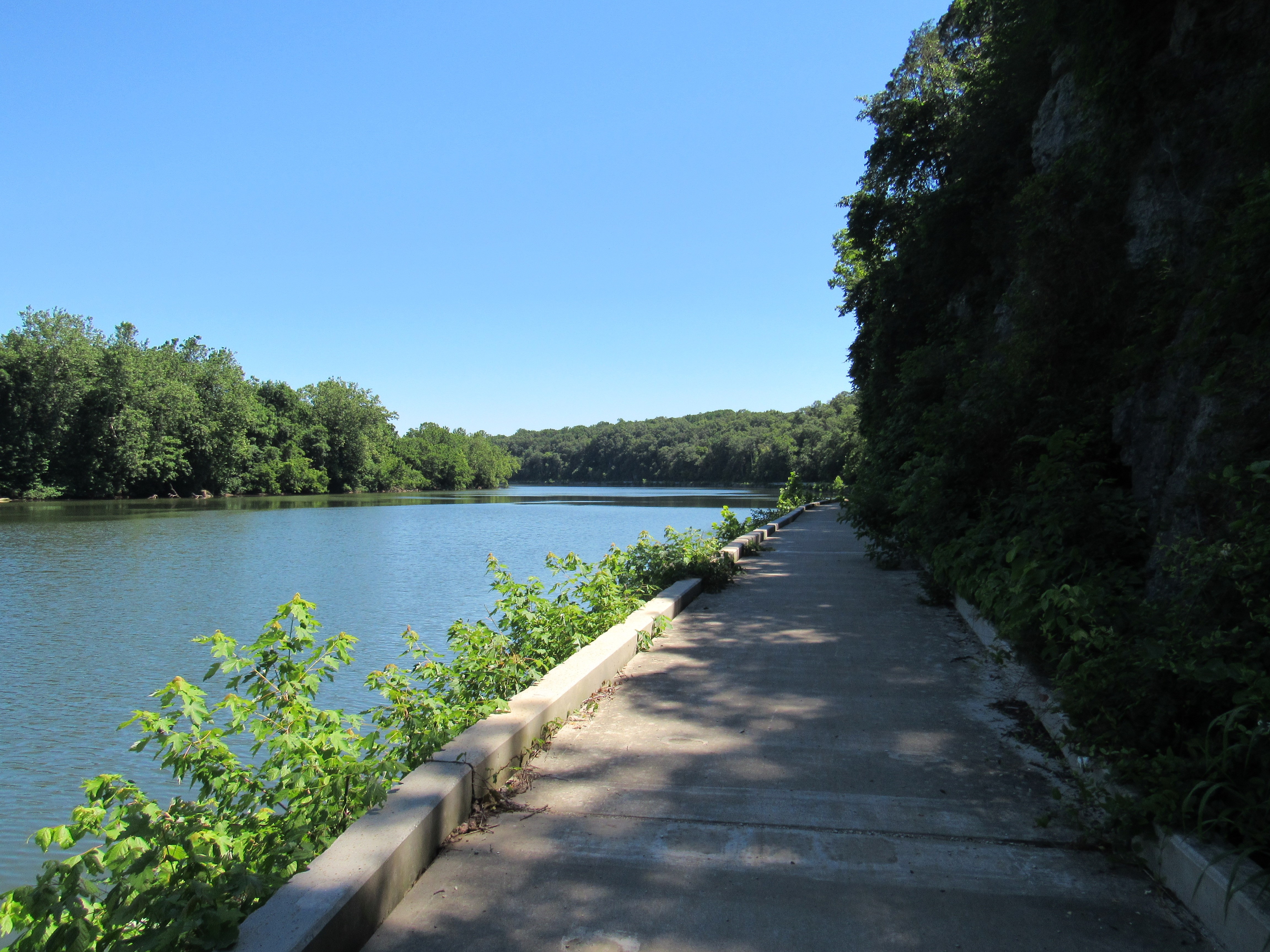
As it turned out, this small section that I road walked around two years ago, may have been one of the most scenic sections of the towpath. There is a nice concrete walkway that follows the river, with tall limestone cliffs directly to the right with an assortment of interesting plants, flowers, and bonsai trees. Wide open river views exist the whole way, definitely a rarity on this hike.
Historically, this is also an interesting spot. The river was dammed because the canal makers concluded it would be impossible to build the canal through the limestone cliffs. The calm waters of the river, thanks to the dam, would allow the canal boats to leave the canal, be pulled down the river for a short stretch, once the limestone cliffs receded and the canal could be constructed again, where the boats would return to the canal, and the river would continue its wild course downstream.
I passed the midpoint of the hike which felt good around mile 92.5. Crossed paths with a poor kid who absolutely wiped out on his bike in a mud puddle and was covered from head to toe in mud. Tried to help him out best I could until his scout master arrived.
Reached camp around 6:00 and shared the spot with another biker. We made a fire and enjoyed some conversation during dinner. The guy lived a pretty interesting life and was biking from DC to Pittsburg. Fell asleep to the sound of an owl in the nearby trees again...


No comments:
Post a Comment