 |
| Fresh fall near the Tall Tree |
 |
| Giant branch embedded into the ground |
 |
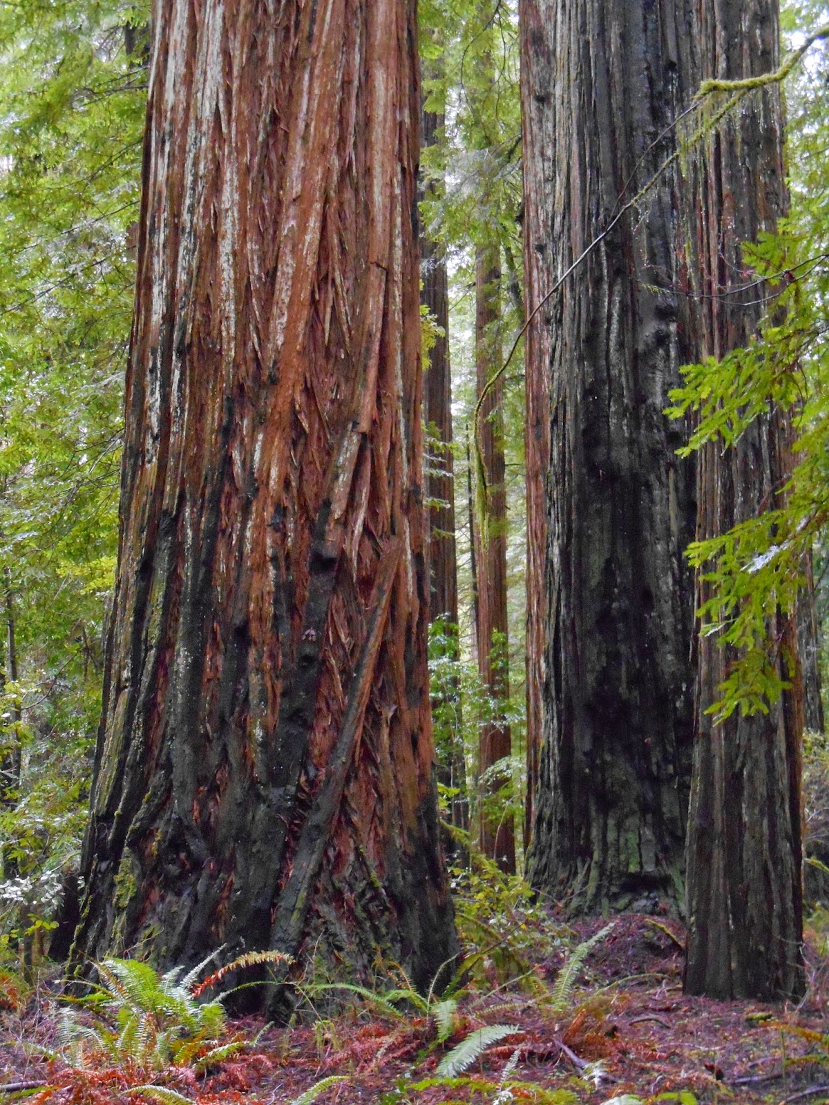
| Fresh fall. A big ol' giant fell which made the forest look like a bomb went off. I'm wondering if I took a photo of this tree a couple years ago, but I couldn't make a positive match. Going to look a little closer next week. Anyhow, the forest looks very different now in this particular spot. |
Lots of rain and heavy winds this week along the North Coast, which has resulted in fresh falls in the forest. I have to wonder how many trees fall on average in a given year in the remaining redwood groves. I got completely soaked before work yesterday in just a few minutes. I accidentally left my poncho at home and my rain jacket is pretty much worthless. I always think that maybe the redwood canopy will shield me from the bulk of the rain, but the opposite may be true. Gigantic rain droplets seems to gather and fall from the canopies, completely drenching my jacket in a matter of minutes. Serious winds have blown through the area the last couple of days. I'm curious to see the effect in HRSP next week. A wet forest makes for great photography and a feast for the eyes though as the colors really tend to come out...
*****UPDATE*****
Weather forecast for Redway this weekend:http://lostcoastoutpost.com/weather/garberville/
Flood Watch
FLOOD WATCH NATIONAL WEATHER SERVICE EUREKA CA 136 PM PST FRI FEB 6 2015 …STRONG STORM SYSTEM TO CONTINUE TO BRING HEAVY RAINFALL TODAY WITH LINGERING RAINS THROUGH THE WEEKEND… .RAINS ASSOCIATED WITH A STRONG STORM SYSTEM WILL MOVE INLAND ACROSS NORTHWEST CALIFORNIA THROUGH THE WEEKEND. HEAVY RAINFALL WILL ACCOMPANY THIS SYSTEM AND WILL LEAD TO RAPID RISES ON RIVERS AND SMALL STREAMS WITH FLOODING POSSIBLE IN LOW LYING AND URBAN AREAS…PARTICULARLY THROUGH THIS EVENING. CAZ001>004-076-070545- /O.CON.KEKA.FA.A.0001.000000T0000Z-150207T0600Z/ /00000.0.ER.000000T0000Z.000000T0000Z.000000T0000Z.OO/ REDWOOD COAST-MENDOCINO COAST-NORTH COAST INTERIOR- UPPER TRINITY RIVER-MENDOCINO INTERIOR- 136 PM PST FRI FEB 6 2015 …FLOOD WATCH REMAINS IN EFFECT UNTIL 10 PM PST THIS EVENING… THE FLOOD WATCH CONTINUES FOR * A PORTION OF NORTHWEST CALIFORNIA…INCLUDING THE FOLLOWING AREAS…MENDOCINO COAST…MENDOCINO INTERIOR…NORTH COAST INTERIOR…REDWOOD COAST AND UPPER TRINITY RIVER. * UNTIL 10 PM PST THIS EVENING * A STRONG STORM SYSTEM WILL BRING AN ADDITIONAL 3 TO 6 INCHES OF RAIN TO THE AREA. LOCAL AMOUNTS OVER 8 INCHES ARE POSSIBLE OVER HIGHER TERRAIN AND ON THE SOUTHWEST FACING SLOPES. * RIVERS AND SMALL STREAMS WILL RISE RAPIDLY AND LOW LYING AREAS MAY BECOME FLOODED. PRECAUTIONARY/PREPAREDNESS ACTIONS… A FLOOD WATCH MEANS THERE IS A POTENTIAL FOR FLOODING BASED ON CURRENT FORECASTS. YOU SHOULD MONITOR LATER FORECASTS AND BE ALERT FOR POSSIBLE FLOOD WARNINGS. THOSE LIVING IN AREAS PRONE TO FLOODING SHOULD BE PREPARED TO TAKE ACTION SHOULD FLOODING DEVELOP. $$


"A wet forest makes for great photography and a feast for the eyes though as the colors really tend to come out... " <--This is my favorite time to visit HRSP too.
ReplyDeleteHey Karen, I just checked your blog and it looks like you do a lot of running? Have you ever done the Avenue of the Giants race? I think it's in May or something like that: http://www.theave.org/
Delete